WILDFIRE RESPONSE
Zones
Photo: Greg Doyle
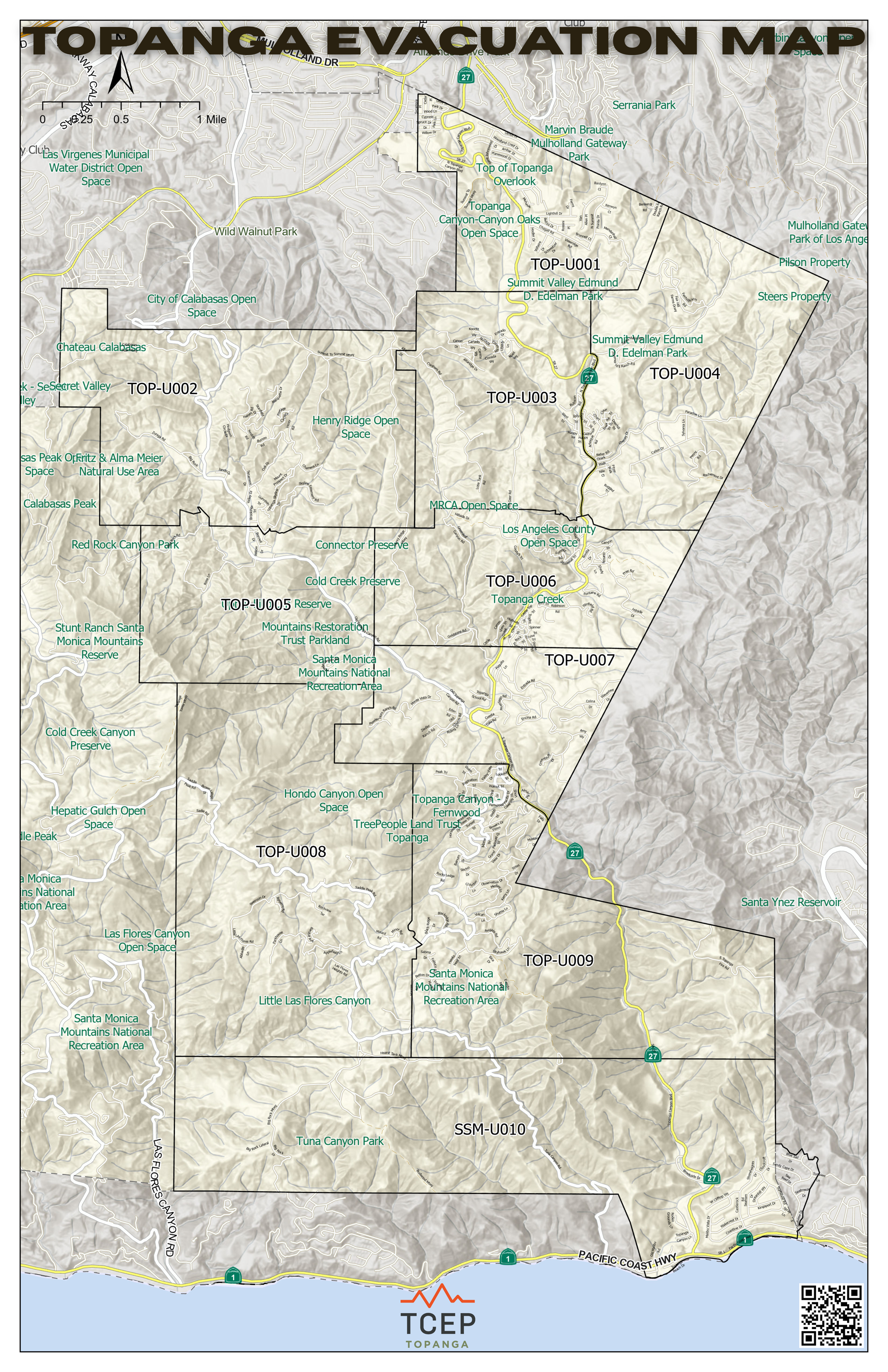
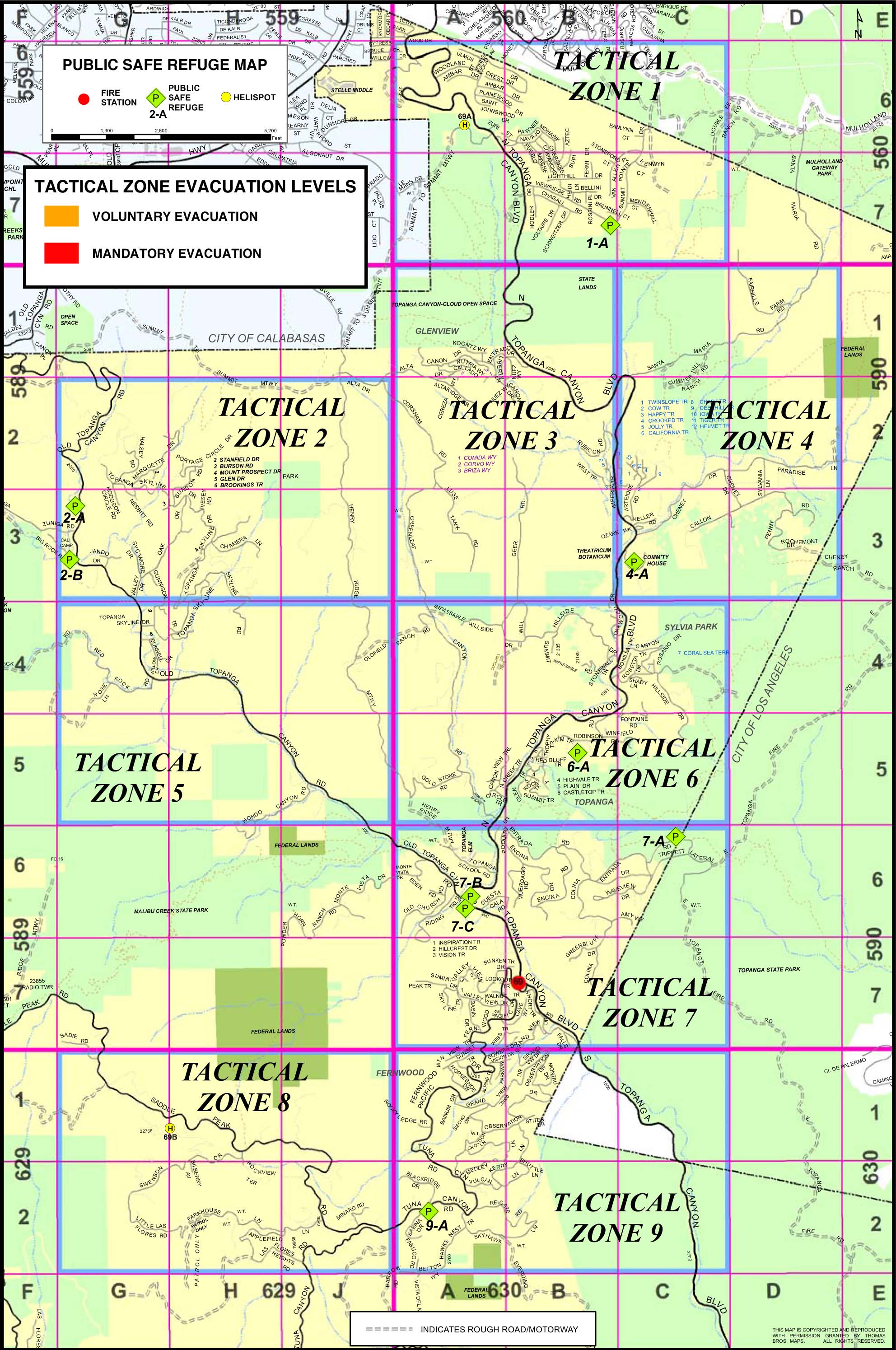
EVACUATING TOPANGA BY ZONES
The Santa Monica Mountains region—including the high fire hazard severity areas of Topanga, along with Agoura Hills, Calabasas, Hidden Hills, Malibu and Westlake Village—is divided into Zones to help manage wildfire and other emergency evacuation notifications.
Interactive Zone maps for the entire area are available online at protect.genasys.com. Enter an address in the Search field to find a particular Zone. In an emergency, LA County will post information in real time for every impacted Zone.
Topanga was the pilot for the Zone program. Our canyon is divided into Zones 1 through 9. Topanga Zones on genasys.com are listed as TOP-U00X. For example, Zone 1 is shown as TOP-U001. (TOP stands for Topanga, and U stands for Unincorporated.) In the event of evacuation notifications, Sheriff and Fire will use the simple label, such as Zone 1 or Zone 2 (minus the TOP-U00) in all public communications.
TCEP maintains a Zone map for Topanga on our Emergency Status page where we list and show the evacuation status for each Zone. We have added Zone 10 to our map, even though it’s not technically a Topanga Zone (it encompasses the Sunset Mesa area), because Zone 10 crosses over Topanga Canyon Blvd (Route 27) which is the major southbound evacuation route out of the canyon.
To understand the steps you’ll need to take when directed to evacuate, download the new 2026 Topanga Evacuation Guide